Rights to Light Surveying
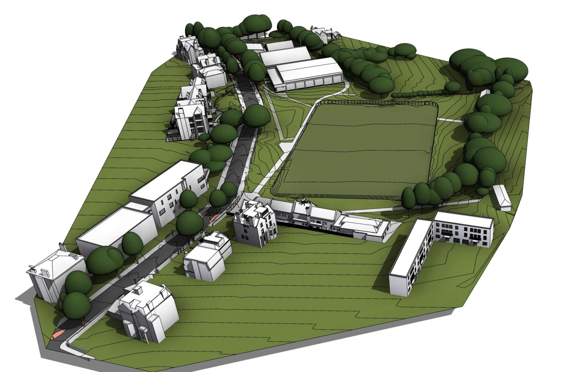
We deliver rights to light surveys to you in a ready to go 3D format. Utilising Laser Scanning, 3D Modelling and drone capture workflows, we can accurately capture and model large areas, to your required level of detail.
What are Rights to Light surveys?
When a new development is required in a built up area, it is essential to survey the sites surrounding context. This enables analysis of the other buildings fenestrations to help realise the impact the new development will have on it’s neighbours Rights to Light. We analyse our point cloud data collected by our laser scanners directly in Autodesk Revit.
By using the point cloud data in Revit we can quickly build the model to the required tolerance by cutting slices through the data and the model simultaneously to check the accuracy.
Rights to Light models
Generally, Rights to Light models are quite low in detail and normally, only populated by external façades and features. The main requests we have are to capture and model door and window positions within the walls, main roof features such as chimneys, dormers and roof lights. Building crowning, balconies and external fire escapes are also regularly required at a higher level of detail. Of course even more detail can be modelled if required.
Every construction project needs to take into consideration its surrounding context specifically during the initial feasibility study. Larger developments in particular can potentially cause overshadowing of the neighbouring properties. This is usually when a Rights to Light surveyor needs to be consulted to complete a report on exactly which properties will be affected and by how much.

Experts in Rights to Lights Surveys
We can collect a huge amount of external data in a very short amount of time. Due to the nature of laser scanning and it’s rapid data collection, we have been able to collect surrounding context and street elevation data for large developments in a single day. This is massively efficient when compared to traditional surveying techniques.
Quick Turnaround
We employ state-of-the-art technology that allows a quick turn around from the site work to data delivery.
Cost Saving
Due to the increased levels of accuracy, there is often little need for correction or re-working. Saving you both time and money.
High Accuracy
The 2D drawings, 3D Models or Building Information Models (BIM) we supply, can be completed to the highest level of accuracy and detail.
How Can SolidPoint Help Your Project?
At SolidPoint, we are passionate about providing accurate and efficiently collected data for our clients and have worked on numerous projects across the UK. If you are looking to employ drone surveying in your next project, please don’t hesitate to Get in touch with a member of our friendly team to discuss your requirements.
Alternatively, you can call us on 01332 898350 or email us at projects@solidpoint.co.uk for more information on our services. We look forward to hearing from you!
Give us a call on
